Boynton Canyon Trail
/
Out on the western end of Sedona, alongside many other trails, is the Boynton Canyon Trail. This trail travels 3 miles into the Red Rock Secret Mountain Wilderness to the northwest of central Sedona. Finishing the trail to the end is essential since the best view is at the trail’s end.
Finding the trailhead parking lot is quite easy. From the 89A in Sedona turn onto Dry Creek Road and follow it until the stop sign, where you turn left onto Boynton Pass Road. At the next stop sign turn right onto Boynton Canyon Road, and the parking lot is just a few hundred feet down the road and on the right.
Parking is limited in the lot, and Boynton Canyon is a popular trail so don’t be surprised if you’re forced to park on the side of the road. To park at the trailhead lot a parking pass is needed, and we were fortunate enough to be able to get a spot after waiting just a few minutes. Passes can be obtained all over the area from gas stations, visitor centers, the chamber of commerce, and even some trailheads. We didn’t have a pass, but Taylor knew there was a machine at the trail where we could get one. Unfortunately, when we parked and went to purchase a pass the machine was out of order. After heading back to the car to get ready to hike we returned to the machine, hoping it would work. Thankfully, there was a ranger there who fixed the issue, and we were able to get a pass! So it seems the trail parking lots are frequented by park rangers, so make sure you have a pass.


The trail starts from the parking lot and leads into the wilderness. Not far from the start there is a turn off for the short trail that leads to the nearby vortex. This is probably the easiest vortex to get to, so it’s pretty popular with people. When we started we could hear a flute playing, and saw someone sitting on top of the rock in front of where the vortex is supposedly located.


From the turn off the trail leads on the side of the rock formations around the Enchantment Resort. This is the least enjoyable part of the hike. The trail is beautiful, but there is a bit of a disconnect since we’re hiking next to the buildings of the resort. Also, shade in this part is limited since we were on the slope of the rock formations. The one nice part was when we were above the resort and got some nice views of the rocks across the property. This part of the trail is only about a mile long.


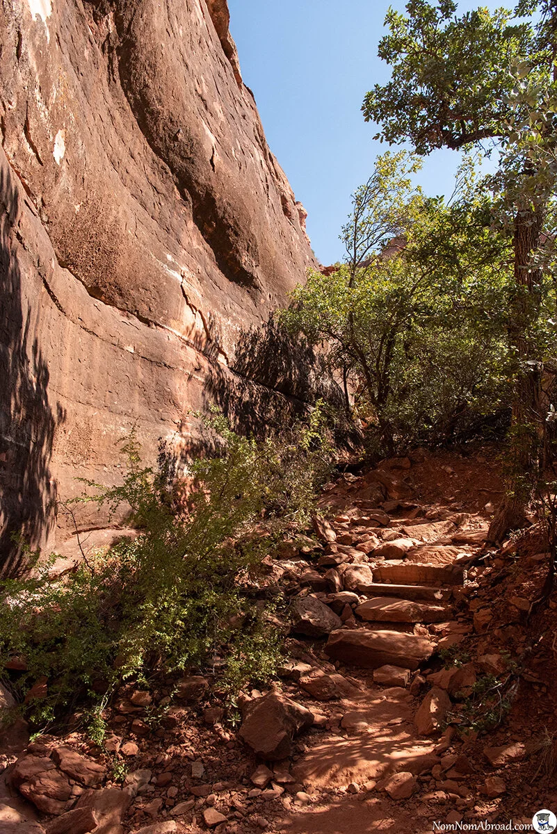


After passing the resort, the trail descends into the basin where there were many dried up creek beds. From here we had more shade, but the ground was a bit sandy and required more effort to traverse. It was still easy enough to comfortably walk through.


Eventually the trail curved into the slot canyon. From here the vegetation slowly changed from the high desert plants and trees around central Sedona to a towering pine forest just to the north. Here we had plenty of shade from the midday sun. Since we were here in October, we also got to see some leaves changing.


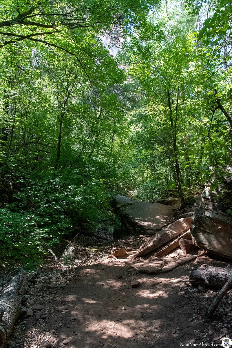
With the second half of the trail being among the pine forest the only downside was that most of the trees blocked out views of the surrounding rocks. We had to enjoy the periodic views we got from breaks in the treeline. Walking through the thick foliage was great though, and there were some wonderful spots where we traveled through a tunnel of branches and leaves.


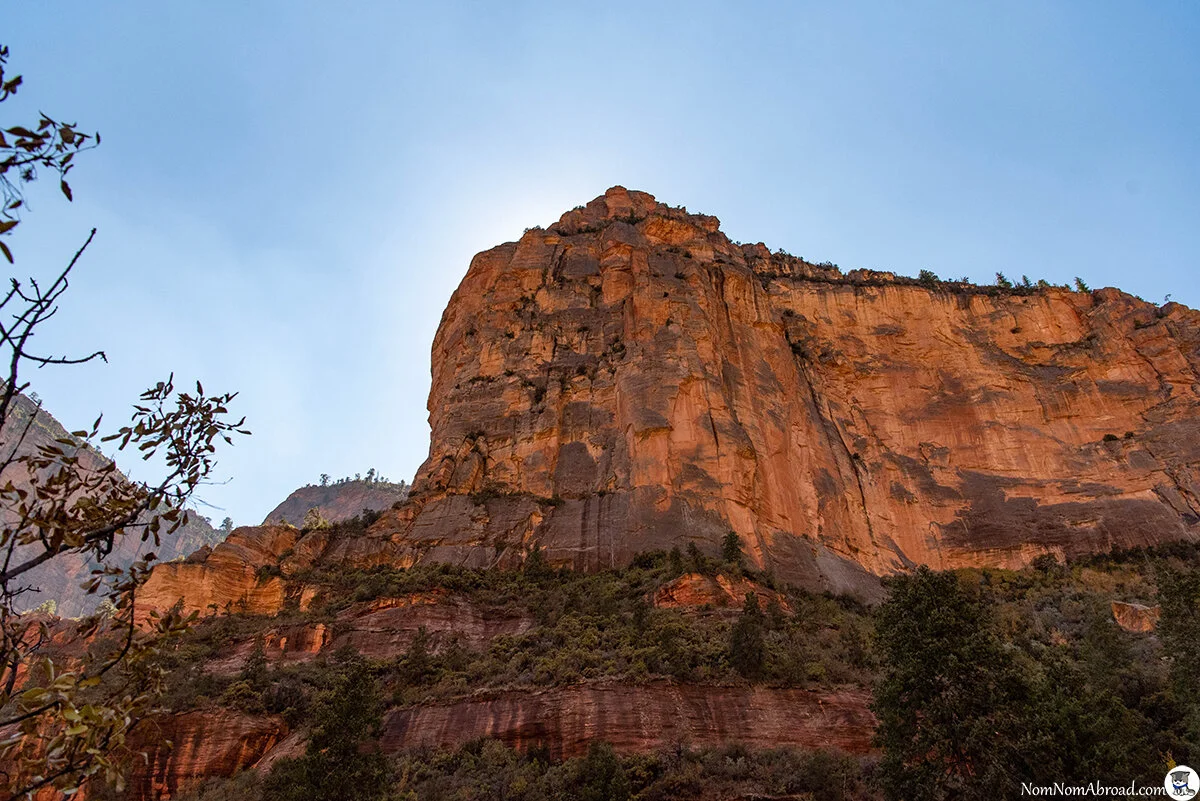
Eventually we reached the end of the trail, which is the most difficult part of this long but easy hike. At the end the trail ascends up the side of the rock formation. Climbing up is tough in some spots since it gets tricky with grip and footing. It’s a bit slow at the end but worth it once you reach the slope where the trail ends.


From the trail end we were treated to the main view at the end of the canyon. At the viewpoint we were able to see down a majority of the canyon we just walked through. Now that we were above the treeline we could see all the surrounding rocks in their full glory. We were lucky enough to get to the end at the right time where the sun was blocked by the rocks directly in front of us. We stayed here for a little bit and took in the view before we headed back the 3 miles.


The trip back seemed a lot faster than going out, but that was probably because we weren't stopping for pictures as much, and we were hungry and wanting to get some lunch.
The Boynton Canyon Trail was probably one of our favorite trails we had been on in the Sedona area. It was a bit longer than we were used to for hiking (6 miles total out and back), but the views at the end were worth it. In all we were on the trail for a little over 3 hours and will happily do it again maybe in a cooler month.
Google Maps Link: Boynton Canyon Trailhead